

I was methodically reviewing features on OpenStreetMap that could benefit from additional attributes, namely missing names and cities. The information on OpenStreetMap feeds into Chicago Cityscape so that the real estate information service I created can show people looking up addresses the locations of nearby amenities, including parks.
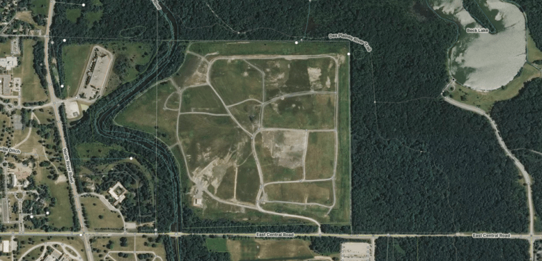
This particularly large park in Des Plaines had no name and no city, so I started investigating. From the overhead imagery view, it looked to me like a landfill.
Since there was a forest preserve to the east, I looked in the Forest Preserve District of Cook County’s nice interactive map for any properties near Beck Lake. Nothing found.
I looked on Google Maps Street View for some insight and there was no name. (Note that data from Google Maps cannot be used to amend OpenStreetMap because of Google Maps having a data license that isn’t compatible with OSM’s openness requirements).
Next I looked at the Cook County parcel map that Chicago Cityscape has to identify its “Property Index Number” (PIN). All of it fits within 04-31-300-003-0000 – the database pointed to “Catholic Cemeteries” as the property owner.
I looked up that PIN on the Cook County Recorder of Deeds to try and find more information. Lo and behold, the most recent document that was recorded against the PIN was for a “Memorandum of Option Agreement” that identified the Catholic Bishop of Chicago as the landlord and Patriot Acres, LLC, as the tenant.
Patriot Acres has a website that describes a new commercial composting facility being built at this location.
I re-tagged the feature on OSM with “amenity=waste_disposal” and “waste=organic” to properly describe it as a composting facility, and not a park. Case closed.